Avery Schmid · 7 September 2026
Drone Technology Exposes Subtle Soil Loss Around Remote Farm Ponds
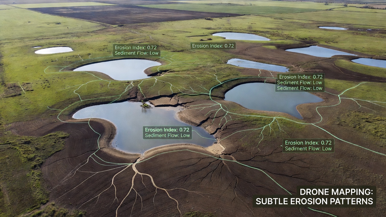
Researchers have turned to high-resolution drone surveys to track gradual soil displacement near standalone farm ponds, and the resulting maps show patterns that traditional ground inspections often miss. These isolated water bodies, scattered across agricultural landscapes, experience incremental changes from wind, water flow, and livestock activity, yet the shifts remain difficult to quantify without repeated overhead observation.
Methods Behind Aerial Mapping
Teams equip small unmanned aircraft with multispectral cameras and LiDAR sensors, then fly programmed grids over target ponds at altitudes between 50 and 120 meters. Software stitches overlapping images into orthomosaics and digital elevation models, allowing analysts to measure elevation differences as small as a few centimeters across multiple survey dates. Data collected in September 2026 from sites in the central United States, for instance, revealed consistent retreat along the northern and western banks of several ponds where prevailing winds align with seasonal drawdown periods.
Ground control points placed at known coordinates ensure the models align accurately between flights, while machine-learning routines flag areas where vegetation cover has thinned or where rills have begun to form. The process avoids extensive foot traffic that could itself disturb fragile margins, a practical advantage when studying dozens of ponds across large properties.
Patterns Identified in Recent Surveys
Maps generated from repeated flights show that erosion concentrates in narrow bands roughly three to eight meters wide around pond edges, with sediment accumulating in shallow deltas on the downwind side. One study covering 47 ponds across two counties documented average annual bank loss of 4.2 centimeters in areas without buffer strips, compared with 1.1 centimeters where grass buffers exceeded five meters in width. Livestock access points accounted for the deepest localized cuts, sometimes exceeding 15 centimeters in a single season.
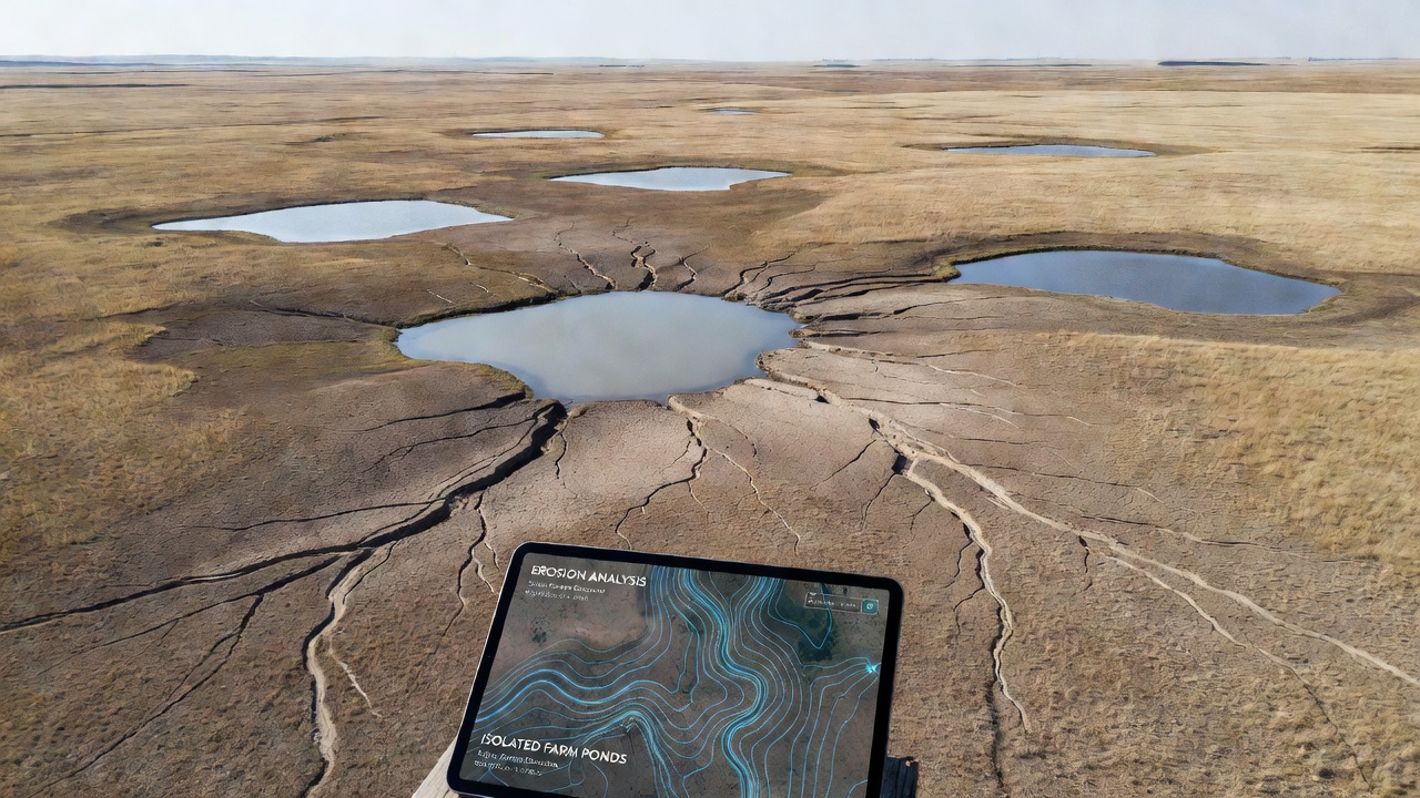
Subtle features such as hairline cracks parallel to the waterline and small slump blocks become visible only after elevation models are differenced over time. Observers note that these micro-topographic changes precede larger failures, giving managers an early window for intervention before ponds lose significant capacity or surrounding fields lose productive soil.
Integration with Broader Monitoring Programs
Agricultural agencies have begun incorporating drone-derived erosion layers into existing watershed assessments. The approach complements satellite imagery, which lacks the spatial resolution needed for individual pond margins, and augments periodic field visits by extension staff. According to data released by the U.S. Geological Survey Earth Resources Observation and Science Center, combining drone surveys with soil-moisture sensors improves predictions of sediment delivery to downstream waterways.
Similar projects in Australia, coordinated through the CSIRO, have tracked comparable patterns around stock dams in semi-arid grazing districts. Those efforts emphasize that seasonal rainfall variability amplifies the visibility of erosion signatures captured during dry periods, when water levels drop and previously submerged banks become exposed.
Practical Outcomes for Land Managers
Farmers and conservation districts receive georeferenced maps that pinpoint priority zones for fencing, reseeding, or installation of hardened crossings. In one county-level pilot, targeted placement of exclusion fencing reduced measured bank retreat by more than half within two growing seasons. The same datasets also support grant applications by documenting baseline conditions and subsequent improvement, satisfying reporting requirements without additional manual surveys.
Because the flights can be repeated at low marginal cost, operators schedule checks after major storms or at the end of grazing seasons, creating time-series records that reveal both acute events and chronic trends. Analysts continue to refine algorithms that automatically classify vegetation health and soil exposure, reducing the time required to process each dataset.
Conclusion
Drone-based mapping supplies detailed, repeatable measurements of erosion around isolated farm ponds that were previously difficult to obtain at scale. The resulting information supports precise management decisions, improves sediment-budget calculations for watersheds, and provides baseline records useful for long-term environmental monitoring programs. Continued refinement of flight protocols and data-processing tools will likely expand the geographic reach of these surveys in coming seasons.